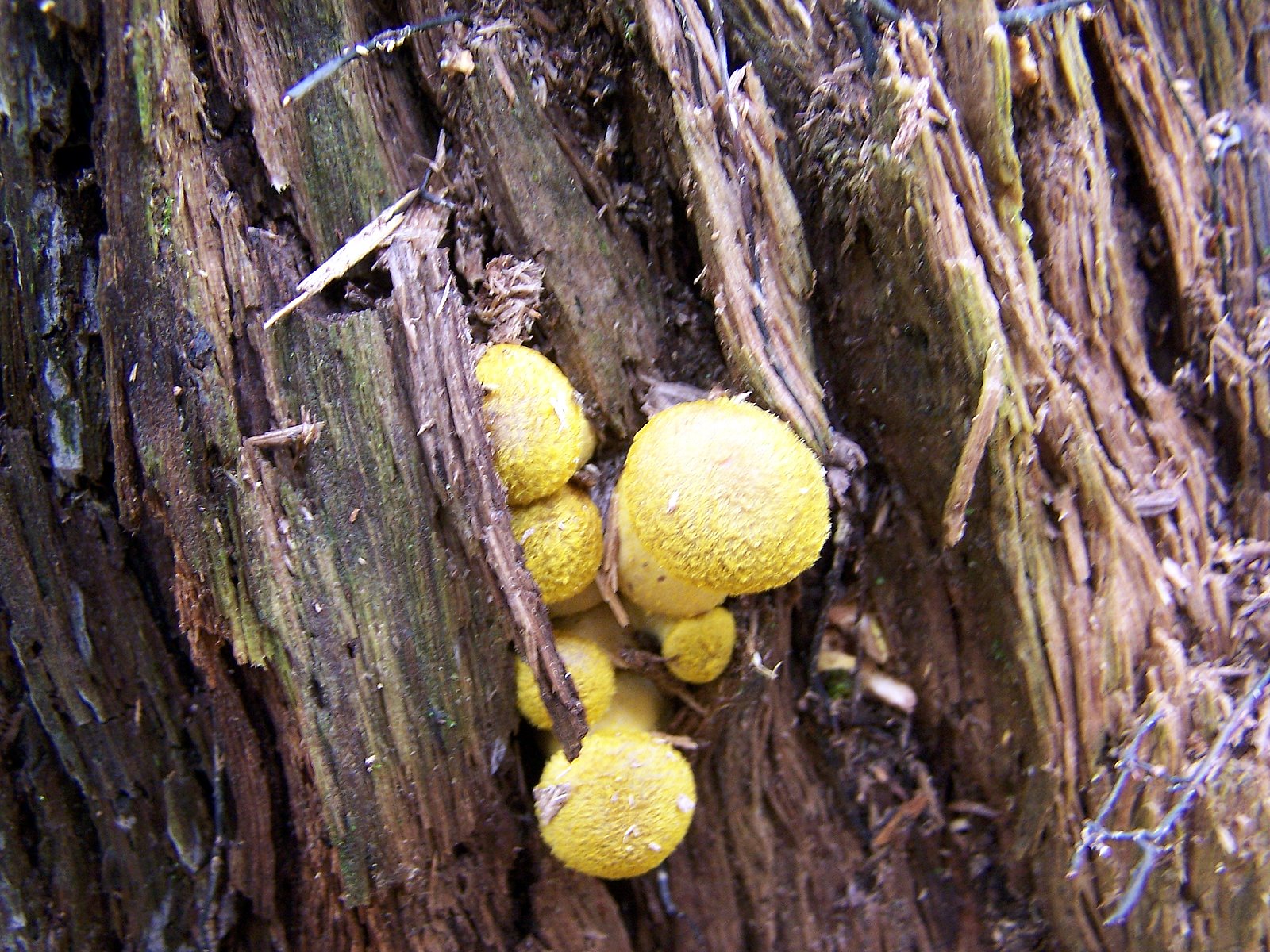
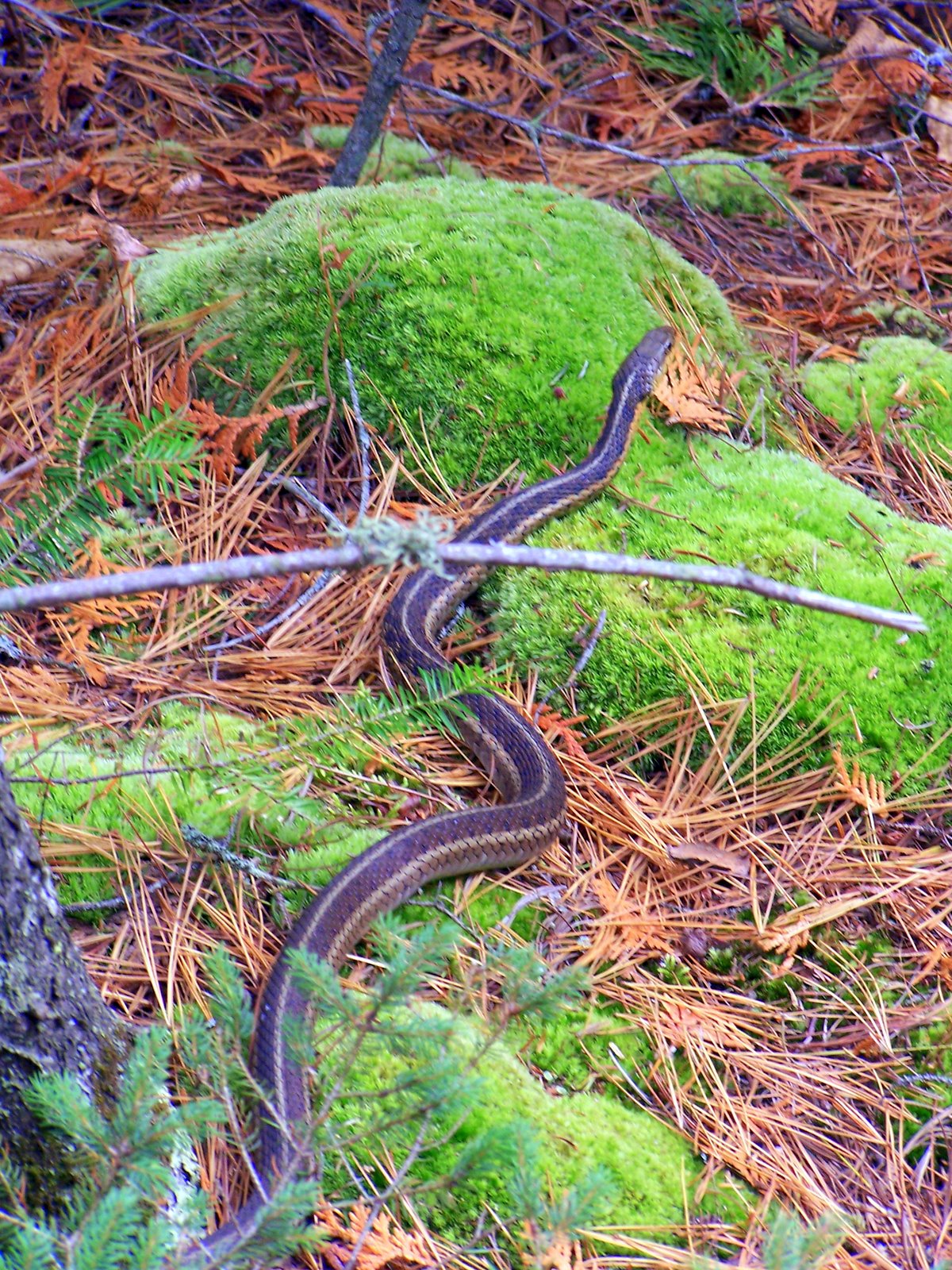
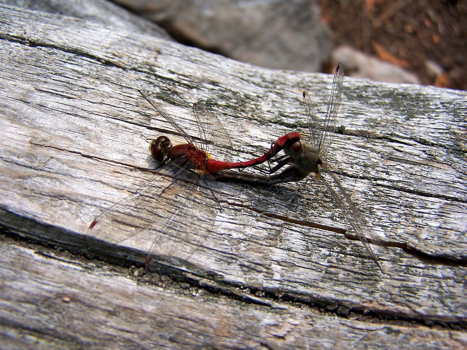
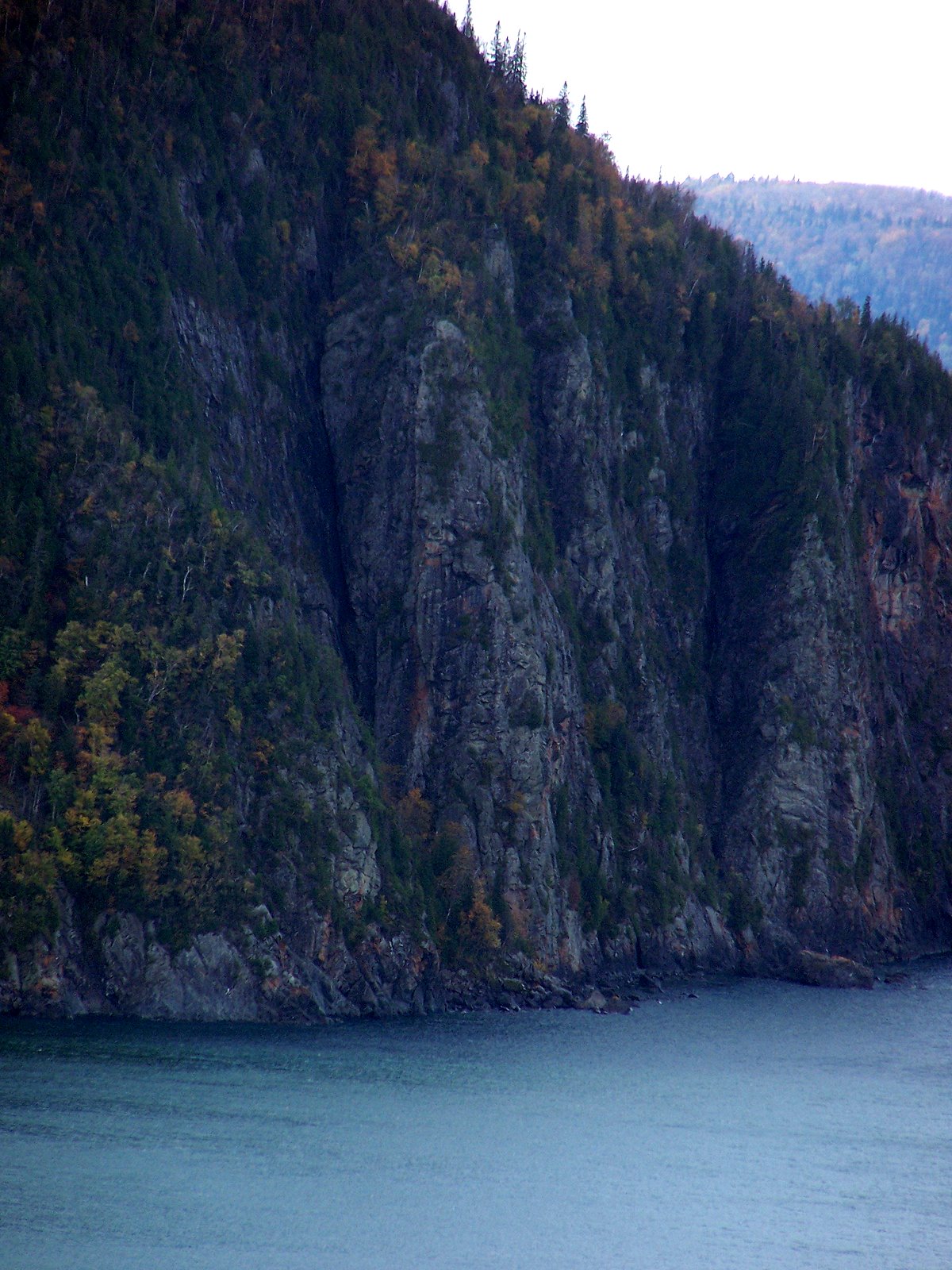
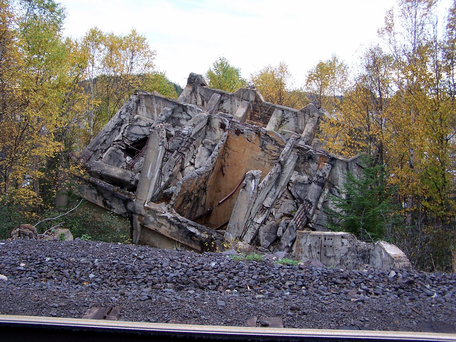
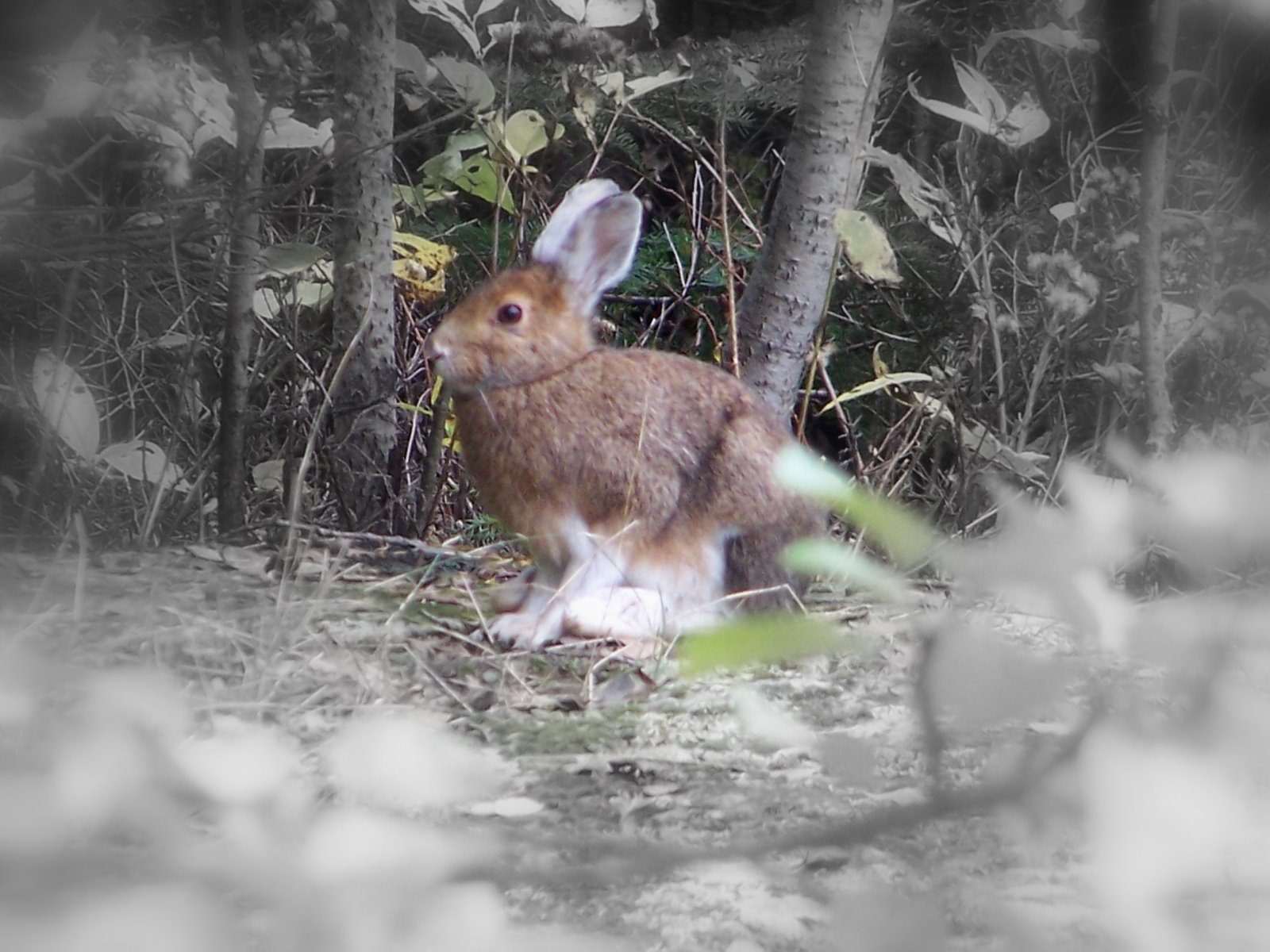
Wednesday, January 23, 2008

Last Trip Post


I guess like the hike, I'm just going nuts with the photo - I can't believe I'm actually all the way through my trip (in a posting sense). I was shocked at how busy Arrowhead was on the long weekend. I guess a lot of people come up from TO. Coincidently - they are holding the Muskoka Loppet there this weekend - although I won't be there yet. I've hardly been skiing yet, so I figured it would be persumptuous to make my first major ski trip to be a race. This weekend, I'm sincerely hoping to get out and do some skiing now that there is some snow and also to add some ski links to the blog.

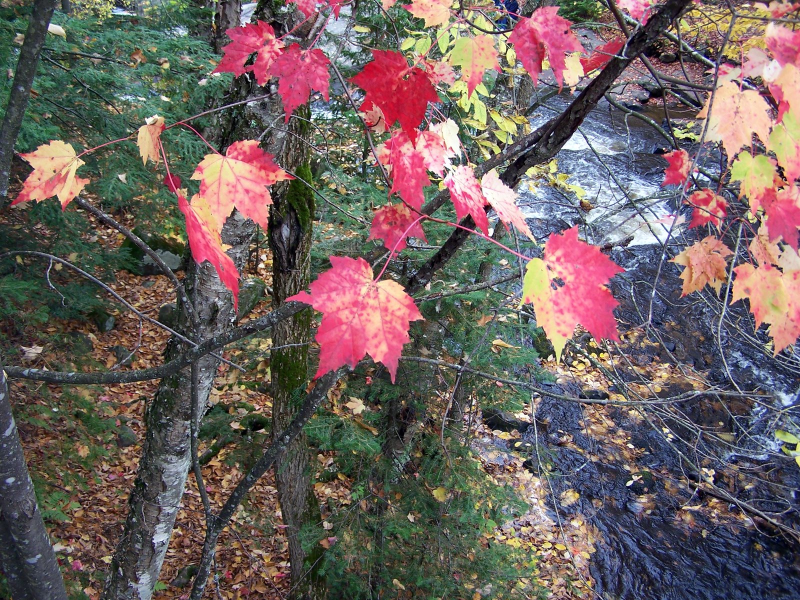
For upcoming stories - well, I do have some back logged stuff - like the snowstorm in TO when our original trip to the Vinyl Cafe was in vain and some pretty wintery pics of the credit. I guess I'm going to have to get my butt in gear and take some new pictures.

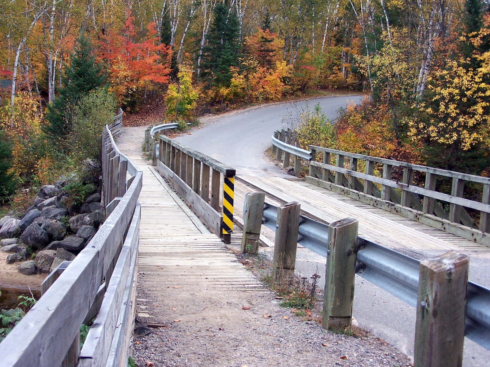
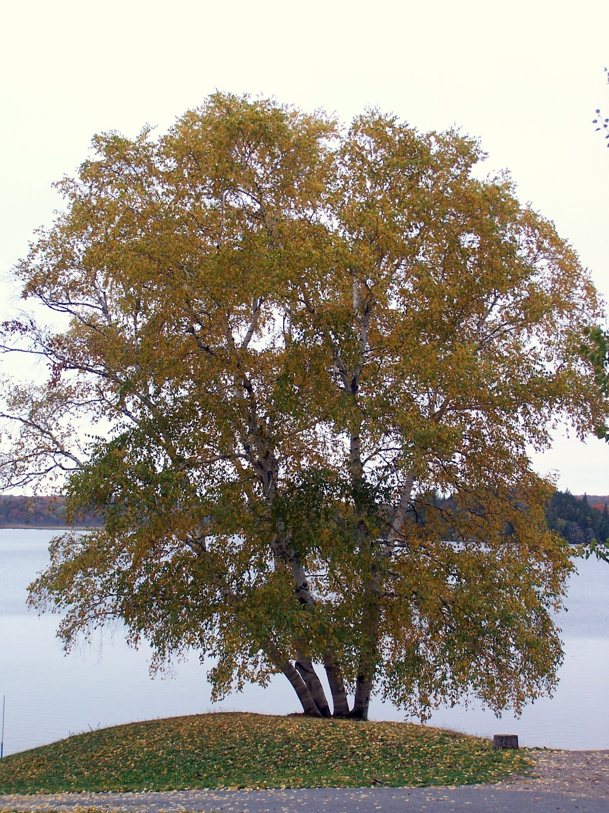
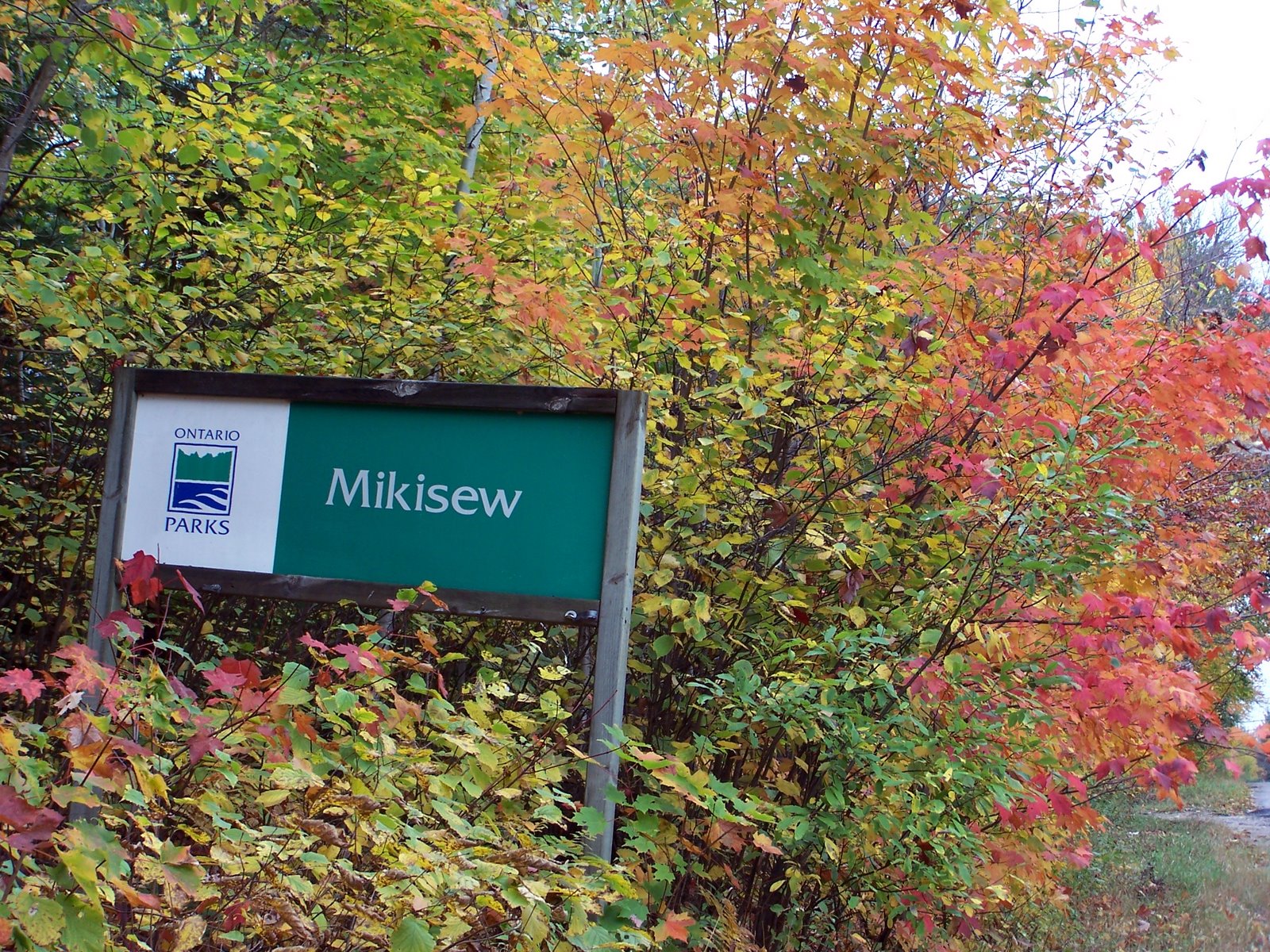
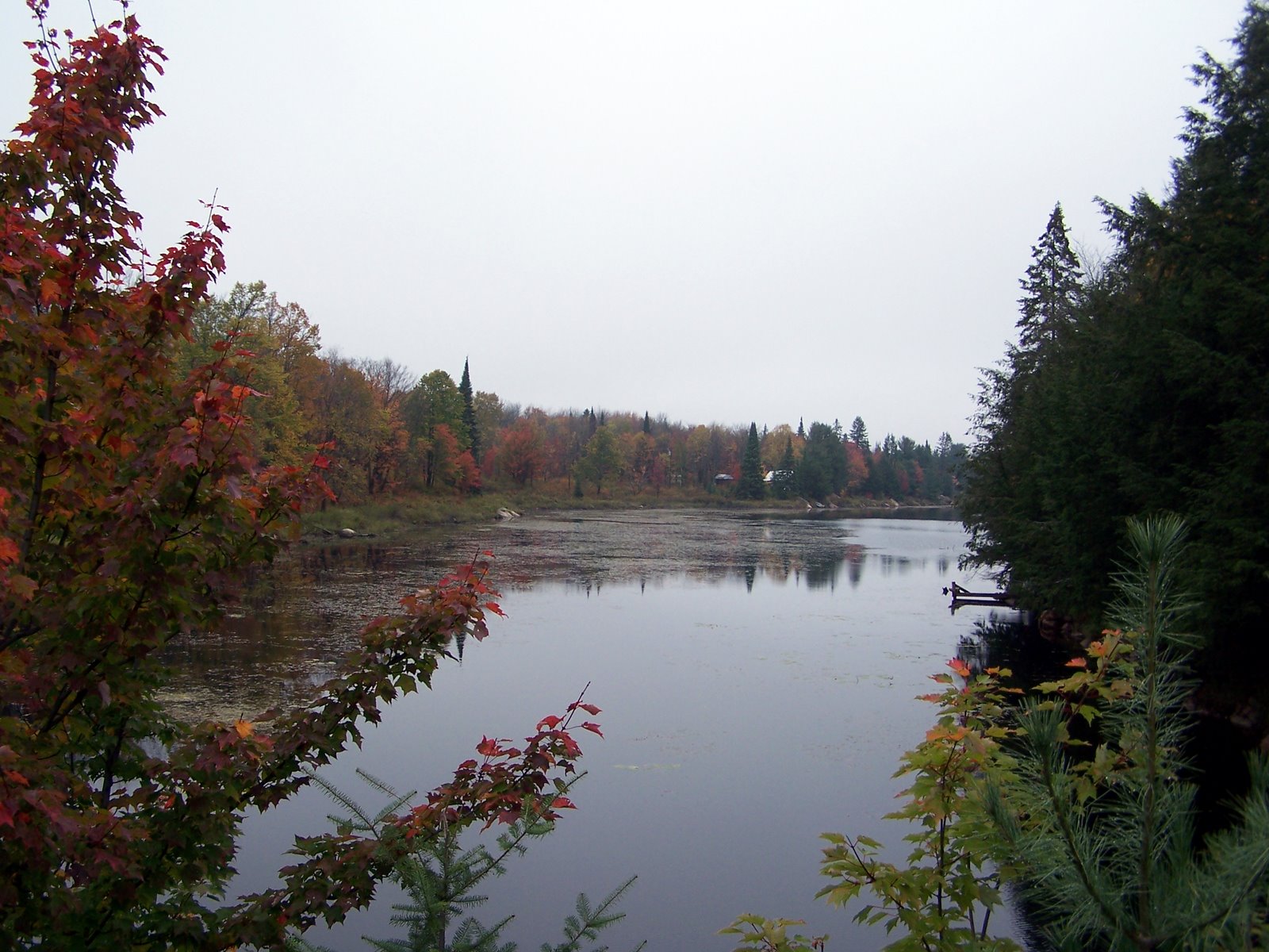
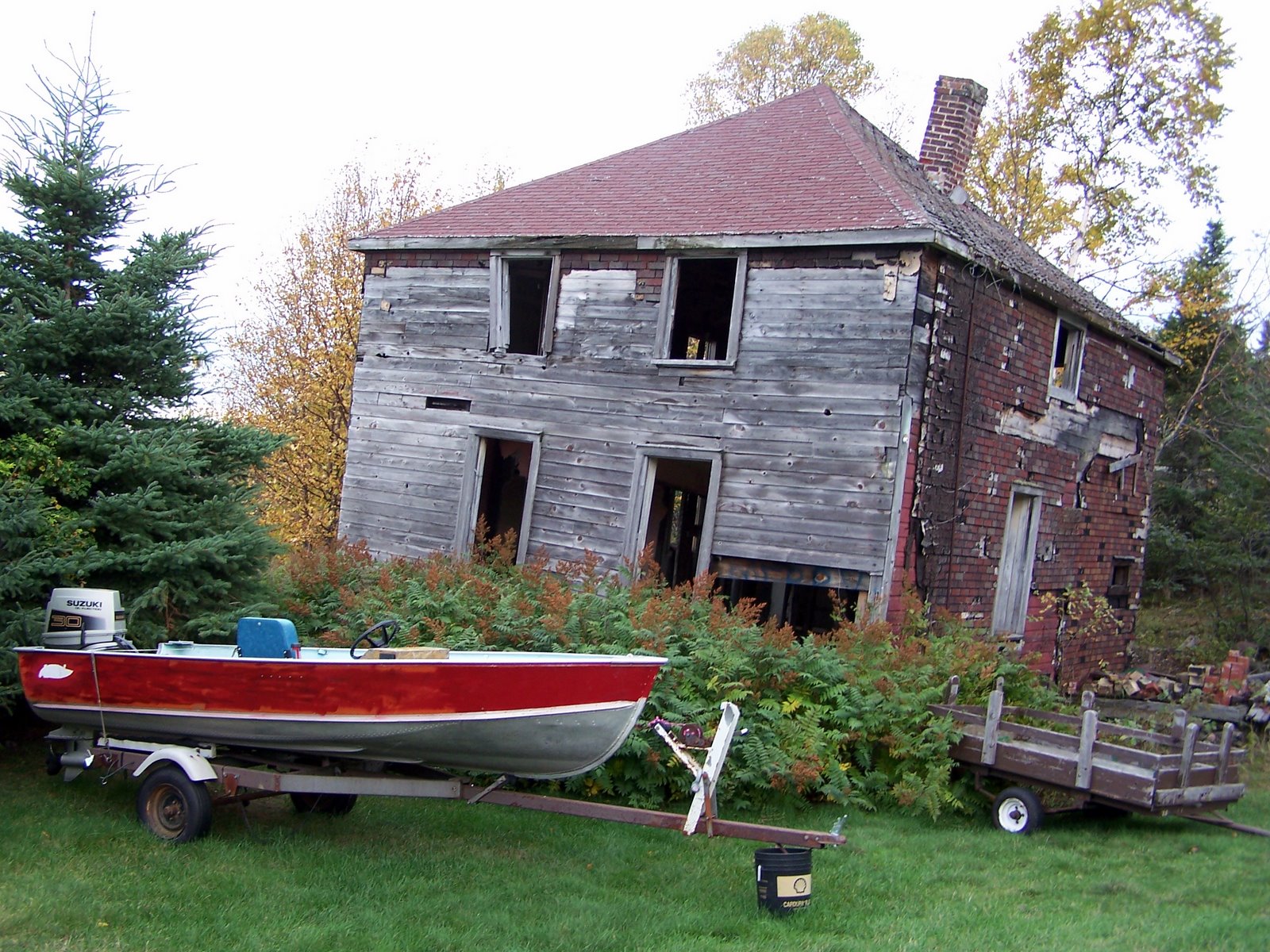
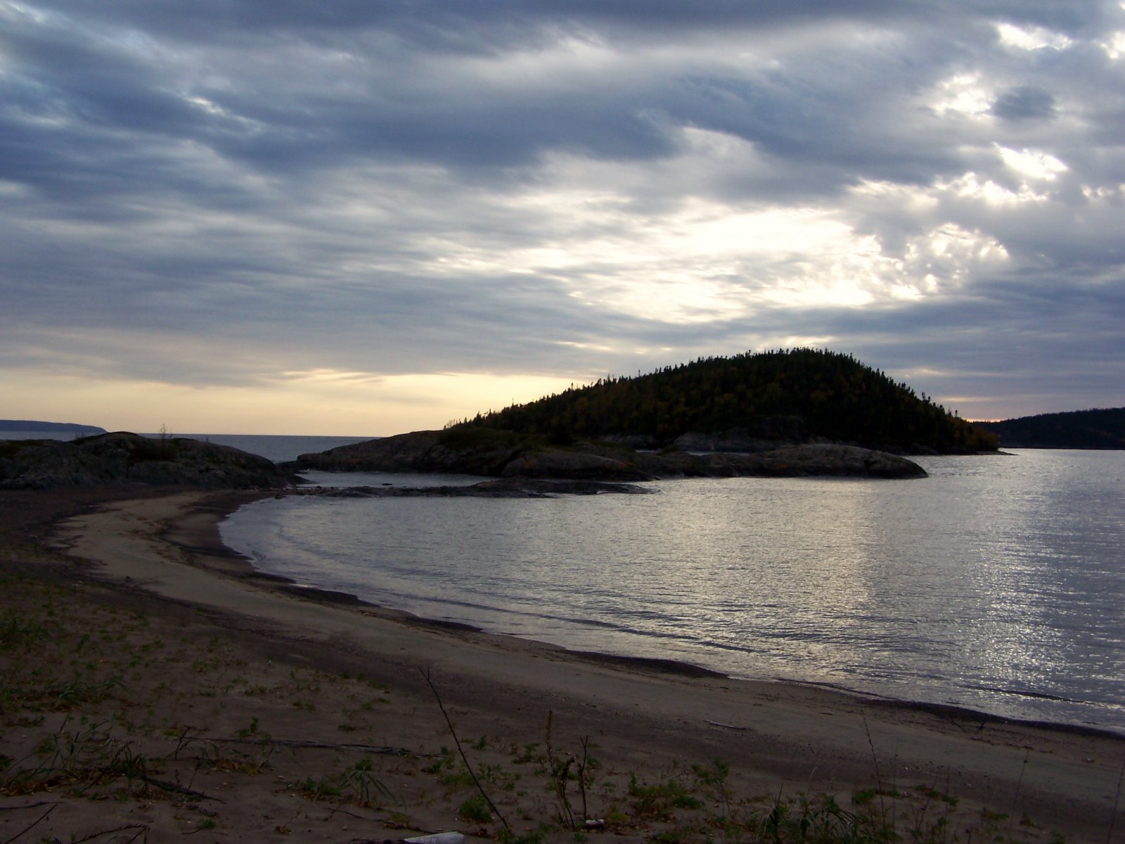
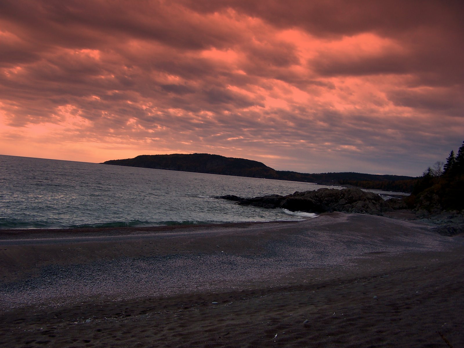
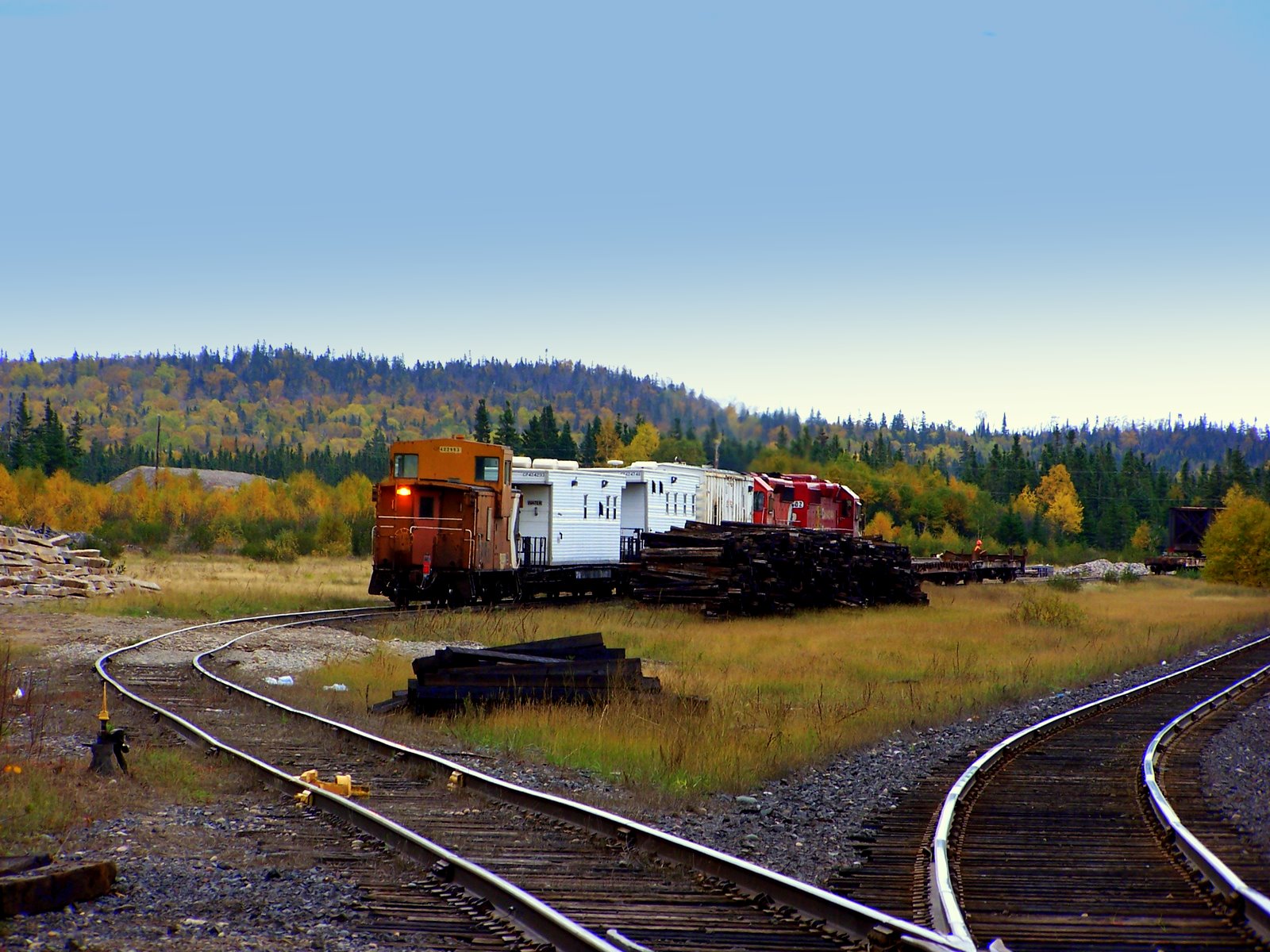
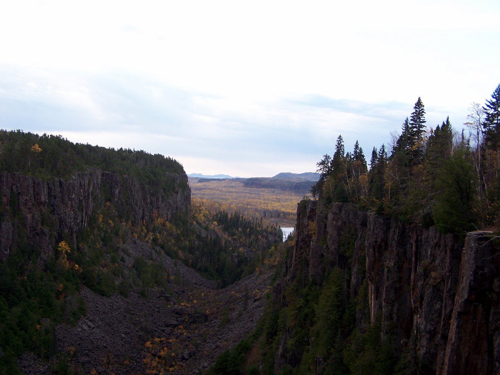
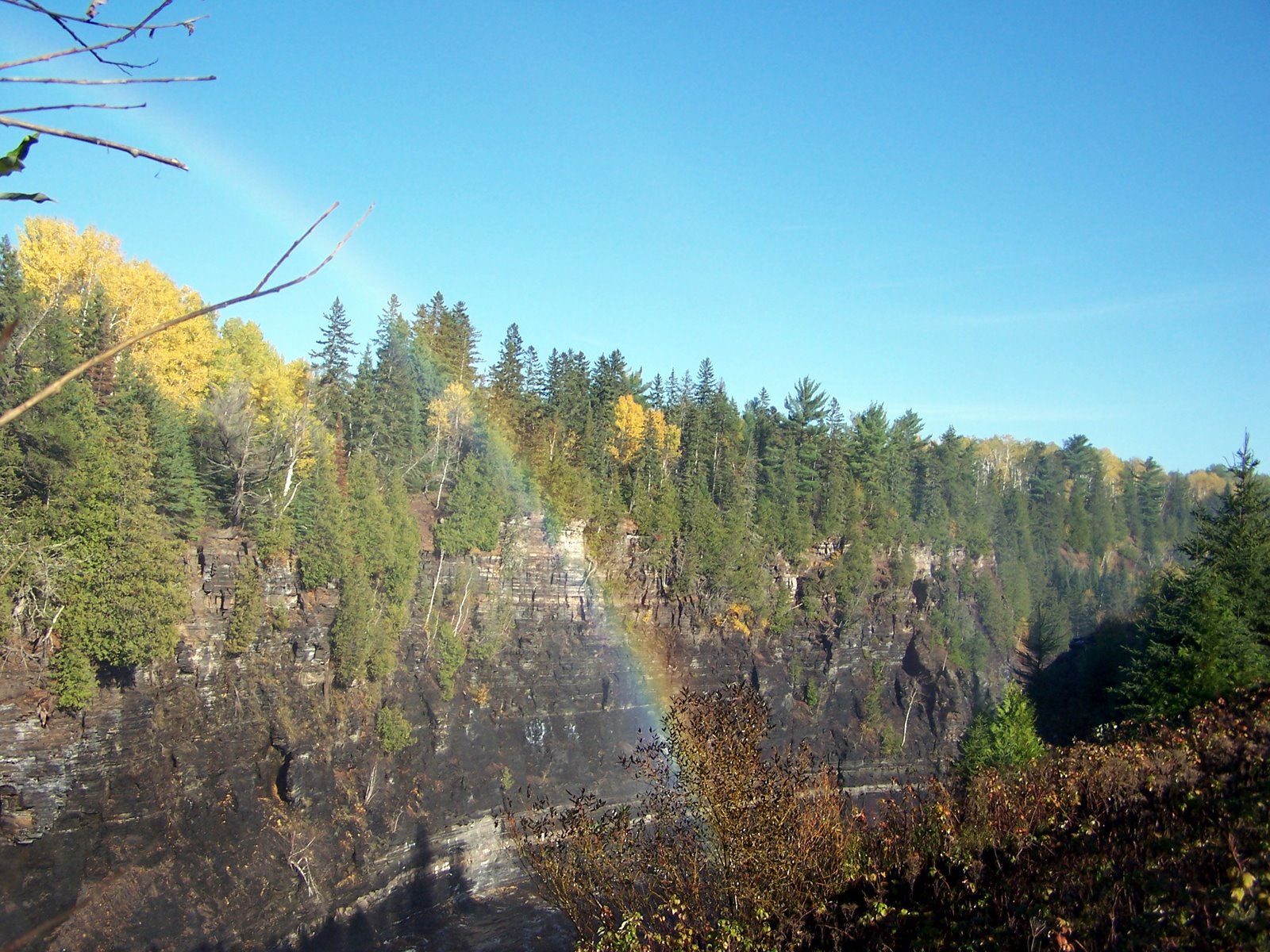
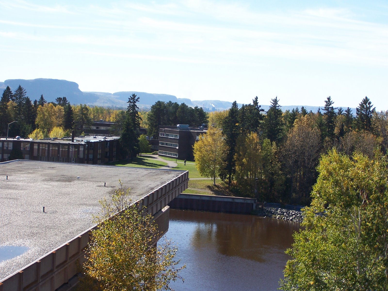
Thanks for sharing my journey with my - I don't think I expected to still be posting so many months later... but it was a fantastic trip full of great moments, good lookouts for contemplation and some decent challanges...and back to my current challange for me.
Posted by Picasa

Labels:

Natural Beauty


I think I took as many pictures at Arrowhead as I had in the preceding day - there was a definate feeling of it being the last chance. I actually almost didn't stop, but I'm glad I did. Although the trail I did was only about 3 km, it was good get out and walk and enjoy the grade A colours.
Posted by Picasa

Labels:

Arrowhead Hike


My last breath of fall colours before heading back to the city on a calm, cool and overcast day.
Posted by Picasa

Labels:

Sunday, January 20, 2008

The Beautiful Blue Yonder

View from the Tower


Here is the distant shoreline, visible from the tower. It was breathtaking - and just plain beautiful
Posted by Picasa

Labels:

Where the road leads and we follow


An afternoon ski, turned into a quick spontaneous trip (the kind where you end up somewhere with no change of clothes or toothpaste). Here we are up the tower near the Bruce Peninsula park tower
Posted by Picasa

Labels:

Friday, January 18, 2008

Final Stop Before Home


At some point I decided that I needed to be home before dark - that I'd had a lovely trip, but another night of camping and more driving just really wasn't in me - so home I went, but to compensate for not making it to Algonquin - I stopped at Arrowhead Park for one last short hike up and down the river - and for the first time in days I was somewhere crowded with people - which left me feeling grateful to the Park Warden for convincing me to stop and stay at Restoule where there were far fewer people. Still there were lots of beautiful natural things to take pictures of at Arrowhead.

I'm stopping my tale here for today - I'll leave shuffling through my 100 or so Arrowhead photos for later. But I wanted to make a few unrelated comments.

First - you will note that I broke the 10,000 hits barrier in my stats below (at least for one of the 2 counters). Secondly, you'll note that I added 2 new links - one to the vinyl cafe (which I was lucky enough to see at convocation hall last weekend and one to Dala - who was one of two musical guests on the vinyl cafe. There is some back story here as we were supposed to go the Sunday before we left for NB - but a snow storm whomped Toronto leaving it eerily quiet and the vinyl cafe cancelled. I do have some pictures of that which perhaps I'll get to post in a week as I start catching up to January.

Finally, you'll knote a knew knitting lynx section - I'm still working on this, but it'll take me a while to fully develop it.

I think that is all for now.

Cheers,

Jennith
Posted by Picasa

Labels:

Another Gratuitous picture of the Doe Lake Shoreline

The Glorious Doe Lake Birch Tree


Drapped in robes of gold this Doe Lake Icon never fails to tug at my heart-strings. I couldn't find the director, so my visit here was short - but I've rarely seen Doe in the fall.
Posted by Picasa

Labels:

Highway 11 Gas Station South of Burk's Falls


There is a restaurant/gas station where we used to get milk shakes at camp. (the name eluding me) - and it was also the place where I saw some of the best fall colours.
Posted by Picasa

Labels:

Mikisew Provincial Park


I think my intention was to park on the road and explore more, but I was definately ready for home at this point... so I took a couple of pictures of the enterance way and headed on to Burk's Falls and Doe Lake.
Posted by Picasa

Labels:

Thursday, January 17, 2008

The road goes on


My mishap with the not so continous Rye Road ended me up on highway 11. I visited a little store in Trout Creek - asking after Thelma - but perhaps I have the wrong town. There was a huge dog show going on in the arena and dogs everywhere. I think in Sundridge (but possibly before) I ended up back on back roads and travelled around Eagle Lake - on roads that were a single lane of dirt in places... but again.. beautiful country
Posted by Picasa

Labels:

Quiet Lands and Yesterdays Farm


I suspect actually that this barn is still in use - but it made a great picture nestled in the back roads between highways 69 and 11. I did some good getting turned about - or rather finding that the roads on my map were not the same as the ones on the ground requiring me to adjust my route accordingly. I was heading through the back roads toward Doe Lake and Mikisew Provincial Park. It was quiet and peaceful and beautiful. I love backroads.
Posted by Picasa

Labels:

River in Restoule Park


My last day on my fantastic road trip was gloomy and foggy. Had it been sunny I would have redone the hike from the day before and take some pictures, but it wasn't so I opted for a short and easy little jaunt through the woods along this river between Stormy and Restoule Lakes.

I was up early enough that it was nearly deserted and I enjoyed the fall colours.
Posted by Picasa

Labels:

Restoule Lake


I'm on shaky ground with the name of the lake - there are actually 2 there are 2 lakes and this actually may be stormy lake. Here is the map - the little lake to the north is Stormy Lake and the larger lake to the south is Restoule Lake.

View Larger Map

Labels:

Monday, January 14, 2008

Restoule Provincial Park


Restoule has been on my list of parks to visit for a long time. I arrived there about 2 hours before dark. I was tired, cold wet and trying to decide if I could make my last planned stop (Algonquin). The park's warden was a right con artist, and recommended that I try this lookout firetower hike (8 km return and on challanging terrain). He worked hard to conivince me to stay there rather than at Arrowhead and described the trail as 4 km. Of course, that was only one way. I read the little blurb before I started and realized that I was about to embark on an steep hike, 2 hours before dark on a rainy, miserable day that was twice as long as I'd bargained for. I sighed, though about it, inventoried by backpack to ensure that I had 2 flashlights (with batteries) and some food and water and decided to go for it. Actually, I speed walked it and finished all 8 km in just over an hour (as the guy at the desk suggested), but I felt that either he'd looked at me and figured I knew what I was about, or was crazy, because I wouldn't have sent most people on that trail at that time of day in that weather. I think the worst part is that I realized just as I got to the lookout that I wasn't going to be able to see anything because of the fog.... and so without even trying to take a picture until I was halfway back down (part of how I kept my time down) I turned around and headed downhill incredibly thankful for my hiking poles given the slippery rocks. Everyone should hike with poles. Its not only safer for your knees and ankles but it turns hiking into a whole body affair and certainly made a lot of things easier. By the time I got down, I was running out of steam and light. I was also the kind of damp that you can only get from vigourous exercise on a rediculously humid day, so I decided that I was convinced and headed back to the desk to pick my site. I took one suggested to me, but in the end I opted for a site accross from the bathroom, where I could take advantage of the light from a street lamp. Then I pulled out the wood that I'd been dragging from my first night in Lake Superior Park and decided to have a fire since it was my last night and began struggling to split it into kindling sized pieces. This quickly became frustrating until a kindly man appeared at my site with an armload of softwood saying little more than "you'll have a tough time getting that hardwood started, here is some night dry pine." The man made my evening with his act of kindness - saving me from a long and dangerous struggle with my questionably sharp axe and some insanely tough hardwood. I easily split the softwood (I'm actually okay at spliting normal wood) and built one of the best fires I've ever had and kept it going until 11 singing campfire songs. It was a nice last night. I can explain in words how I felt - kind of independent and triumphant and reminiscent. I sang all the campfire songs I could remember and parts of ones that I could only remember parts and then I sang some Depeche Mode songs and some songs from the days when I was in the Gr. 7/8 choir at Davis and here I shall stop for today... saving the last few stops of my trip for another posting, and then perhaps I'll get a chance to catch up to where things are today.

Posted by Picasa

Labels:

Highway 522


This road definately left an impression on me. The day was misty and quiet and there was almost no traffic and few signs of people for the first stretch. It was beautiful in a wild sort of way. As I got closer to Restoule Park, my ultimate destination - there were a few villages and cottage towns nestled by lakes and a few more farms, but it remained pleasantly wild.
Posted by Picasa

Labels:

Next Stop: Grundy Lake


My stop here was extremely short - about long enough to scramble the already scrambled contents of my car in a hunt for my cell phone. I had feared that it was left somewhere or lost on a trail. I can't remember where I found it, but I think I'd looked there and it was where I'd expected it to be, but somehow I hadn't been able to see it or some such nonsense.. it reappeared, I took a couple of pictures... checked the map, packed up the mess and headed down highway 522. Grundy Lake is another place I'll have to come back to and spend more time.
Posted by Picasa

Labels:

French River Provincial Park


A lot of this trip had been about seeing as many provincial parks and natural wonders as I could. When I get to the end of my trip, I'll have to post a complete list of the ones I visited. The last 2 days though, I saw a total of 7 - although a lot of my stops were limited to stoping, hopping out of the car, taking a picture and hopping back in. At the French River, I stopped and checked out the new visitors centre as it had been under construction the last time I was out this way. They've done a great job of putting together a display highlight the local fur trade history in particular. Owing to the wet conditions, and the number of km and stops lefts ahead of me, I opted not to hike up to Recollet falls (although I hope to do this sometime). I have been on the other side of Recollet falls (I believe named after some missionaries who perished in its wrath. At the time we were looking forward to an easy portage as there was a kind of rail cart for canoes back then at the site, however when we paddled up the the falls (in early may) they were raging and unapproachable and the contraption to assist in portaging not to be seen. So, we pulled out at a resort downstream and 2 of our teachers hiked/hitch hiked back to the lot where our cars were parked and came to pick us up on the beach. I'd love to canoe the French River again too... perhaps one day.
Posted by Picasa

Labels:

Wading in the Water


Remember that I hiked 13 km + the day before, so this felt good. The water was cool, but not icy and it allowed me to get a bit closer to the falls. You'll note that my sandals don't match. I managed to kill the left one of my old favourites (the brown Jack Wolfskin ones) and one of the newer wind river ones (that I bought on sale for $4.99) a couple of years ago. Unable to find a new pair that was either fantastic enough to pay a significant amount of money for or cheap enough to buy for the sake of having matching sandals at the end of the summer - I decided that I'd hold out and finish out the year in mismatched ones.
Posted by Picasa

Labels:

2nd falls, Les Chutes Provincial Park


I didn't actually get that close to the falls... it was a fair hike to a place where I could zoom in and I decided I still had some serious ground to cover and I wasn't really dress (i.e. sandals) for a long hike.
Posted by Picasa

Labels:

Here is teh view from the Viewing Platform at the falls.

Les Chutes, Massey


The rain was still driving down when I stopped to check out the round barn - a drafty, 12 sided, 78 year old barn that held a craft shop. I took a quick look, dashing from my car to the door in an attempt to minimize how soaked I got. Its a landmark - see the link for a picture and description. The building style dates back to early settlers in the area.

The Chutes Provincial was my next stop. I had a nice chat with the Parks Warden upon entering. The falls, although small compared to the roaring Kakabeka, Pidgeon River and Agaussabon falls. They had a picturesque charm. I was able to wade in the pool at the bottom. The Riviere Aux Sables - lived up to its name - and the pool was a sandy area used for swimming in warmer weather. I took some time to hike up river and check out the upper falls and it finally stopped raining long enough for me to dare take out my camera. I did hike in my sandals at the risk of getting Poison Ivy.

I'd definately camp out there sometime on route West or East. It may not have been huge, but it had a nice trail and the sites were wooded.
Posted by Picasa

Labels:

Thursday, January 10, 2008

Carolyn Beach Motel


I've actually stayed here on dark and snowy December night when we rolled our station wagon just outside of Thesselon, ON. In fact, you can litterly probably see the point where we flipped in this picture... The quick version of that story was that the roads were somewhat bad, and the driver had mistakenly picked the wrong leg of a V - heading into Thesselon rather than Toronto. The front passanger had suddenly noticed this and called out and the driver had tried to switch legs - at which point I woke up in the middle of the back seat where I'd been dozing and seen snow flakes spinning in circles. Giving the driver credit she did manage to pull out of the spin and into a straight skid - until the car hit some slush and proceded to spin in the other direction until we came to a stop facing backwards on about a 45 degree angle on the edge of the road. It might have all ended well there - but as I declared "Thank God, we are going to roll" and ominous creak in the car top carrier as the drivers books shifted toward the downhill side and the car rolled over into the snow filled ditch. However, whatever diety was out there was watching out for us as the injuries were limited to me getting a fat lip (I was trying to help the driver out of the car - and her seat belt whipped me in the face when it was released) and the damage was limited to a cracked CD case that got crunched as we tryed to exit the car, the scattering of a 2 kg bag of worthers candies and both side view mirrors bent, a couple of litres of fluid lost and a small dent in the car.) This time I just stopped for a lovely cup of coffee and to read my map and then it was eastward ho.
Posted by Picasa

Labels:

Pancake Bay Provincial Park - my second last night


Well, we've reached the final leg of my trip. After completing the 8 km Orphan Lake (and earlier in that day, the challanging 5 km trek up the Nokomis trail), I was exhausted. I drove down to the Trading Post (Agawa Indian Crafts) and bought some gifts for people. A neat carved face for my dad, little soapstone boxes for my mom and Gabe and probably something else I don't remember. I then went to Pancake Bay where I claimed my free 4th night at a provincial park and took a few pictures. I had canned spaggetti for supper and camped in a pretty site next to two college students up from Sault St. Marie - one of whom was a fabulous guitar player. Shortly before I had supper properly cleaned up, the sky opened up and poured a torrential ammount of rain everywhere punctuated by frequent and intense bursts of lightening. I grabbed everything I didn't want wet and chucked it in the trunk then ran for the comfort station where I made some short nervous calls home (lightening and phone calls don't mix and I crawled into my back seat and read for a while until the storm let up long enough for me to feel somewhat safe having a shower (the lightening was really intense) and make it back to my car just in time for the rain to resume. Meanwhile my neighbours came by and offered me some extra spaggetti they had, but I think they though I was nuts of hiding in my car. I slept poorly and it continued to rain unabated all night - until I gave up at 5 am and hit the road (in the pouring rain) and headed south to Sault Ste. Marie. I stopped in the Sault where I believe I had a yummy McDonalds Breakfast and bought gas at a petrocan on the highway strip. Both times I ended up talking to random people. In McDonalds I chatted with a table full of older folk about the weather and weather it was unusual and in PetroCanada I talked to the attendent about thankgiving and familes and stuff... Nice folk there... then I started heading east. I guess I should say something about driving in the rain. There was a lot of it. Rivers were swollen and at one point only the flashing lights of an attendent cop car warned me that there was water flowing over the road at one point (which I think later resulted in the closure of the road - so my early start might have worked out for me. I drove through the water slowly and carfully (it wasn't deep, just crazy). It was dark until well past Sault St. Marie and my wipers were in overdrive (my wipers are one of the suckier things on my car and even in overdrive there was a limit to what they can do with that much rain. There is a strange and comforting feeling to driving dark roads on rainy nights with Dave Matthews crooning and Tim Reynolds working miricals with a guitar - its one of those moments that you feel alive and centred. It was a good morning - although I was sad that I didn't get more of a chance to explore Pancake Bay - there were at least 2 trails that sounded great - but the rain looked to stay until later in the day.. and I had some serious ground to cover still.
Posted by Picasa

Labels:

Monday, January 07, 2008

Snake just up from the lake

The second time I had a more cooperative snake and I managed to get 2 photographs of him before he slithered under a rock.
Posted by Picasa

Labels:

View from Beaver Dam Across Orphan Lake


My watercolour paints would love to try this..... one day... one day...
Posted by Picasa

Labels:

Dragonfly Dance


What a fantastic shade of red. I suspect that if my brain is pumping out the correct info these two critters are actually meadowflies (which I believe are damsel flies rather than dragonflies). They are busy on this log jutting out of a beaver dam at the outlet of Orphan Lake.
Posted by Picasa

Labels:

Falls on Orphan Lake Trail

Orphan Lake trail is said to have something for everyone - lookouts, beaches, streams, woodland and a wonderful set of small waterfalls cascading over time-smoothed shieldrock.
Posted by Picasa

Labels:

A chipmunk on the rocks, please!


This charmingly photogenic fellow accosted me (probably seeking handouts) just as I was leaving the beach and heading up a small stream in the general direction of my car...
Posted by Picasa

Labels:

Orphan Lake Trail meets the Coastal Trail


For the span slightly longer than this beach, the Coastal and Orphan Lake trail share the same space. Another pebble strewn Lake Superior beach that was charmingly abandoned while I was there.
Posted by Picasa

Labels:

High Lookout on Orphan Lake Trail, Lake Superior Park


I couldn't decide which to post, so I just put them all up in one post. A view well worth the hike up the ridge.
Posted by Picasa

Labels:

Sunday, December 30, 2007

View from the top of the ridge - Orphan Lake Lookout #2


So here is a piece of the spectactular view I've been warning you about. Over looking autumn bronzed, tree clad hills and the glory of Lake Superior's open water. Note that I started at the bottom of this valley and hiked strait up along the ridgeline to get here....
Posted by Picasa

Labels:

Strange Sentinals

Almost to the top now (and feeling it - I Garuntee you). This lookout was probablythe most challanging for me - likely because it was on the tail of the 5 km Nokomis trail and because the sun came out (nice for pics, but hot and encouraging to small biting flies). Still.... the view was great and the rest at the top greatly enjoyed. Good place to linger and think.

Labels:

Burnout

A burnover section on one shore of the lake was facinating to explore. Lots of birds and wildlife - although I only caught the tail end of a garter snake in a photo.... and then its up, up, up hill to a spectacular lookout!
Posted by Picasa

Labels:

Midway Peatmoss and Cranberry


Just a fun mix of colours growing on a boggy bit of ground beside the trail.
Posted by Picasa

Labels: ,

Orphan Lake from the Bluff


The first part of the trail wanders mainly uphill through the maple-beech woods until you reach the first look out over the lake. Note that you can also see Lake Superior in the distance
Posted by Picasa

Labels:

Thursday, December 27, 2007

Orphan Lake Trail


Shortly after beginning my second hike of the day at Orphan Lake, I came upon these delightful mushrooms bursting from this root. I should be able to at least tell you the latin name, but I fear I've lost quick access to that knowledge of parisitic mushrooms... I'd guess honey mushroom given its colour and shape, but that is just like guessing that someone is named Jennifer since there are so many of them.

I'll complete my journey around Orphan Lake slowly over then next week. But here are the first steps if you can imagine hiking up a trail through the hardwood hills, bright leaves littering the ground, but many still clinging to the trees. Lots of maples in all their scarlet glory. The temperature is that frustrating one.. crisp in the shade and warm in the sun, leaving you stripping layers on and off to manage your temperature. The sun poking in and out of site behind clouds that would bring unbelievablye torrential rain that night.
Posted by Picasa

Labels:

Superior View from Nokomis Lookout


So, Nokomis was my short but challanging hike that first morning back in Lake Superior Park. My next hike would be Orphan lake (8km, medium difficulty), but by the end of it I would be zonked. Still - its a wonderful trail, just as they say, with something for everyone. You really can beat autumn in Lake Superior Park at any rate. I'll have to go back some day to hike to the falls.
Posted by Picasa

Labels:

Wednesday, December 19, 2007

The Face of an Old Woman


Here is a close up of the face of the Old Woman, of Old Woman Bay.
Posted by Picasa

Labels:

Old Woman Bay - from Nokomis Lookout 2 or 3


Lookout's 2-4 were fairly close together and faced the bay and Lake Superior. The cliff you see in the picture is the one containing the Old Woman's face. I think Nokomis means grandmother, but again... my memory is a bit shifty if you go 2 months back.
Posted by Picasa

Labels:

Nokomis Trail - Lookout 1


I found the hike to this point to be one of the most physically challanging, but the view was worth it. In all this trail was about 5 km, but the terrain was more challanging than the Awausee. The first lookout faces away from Lake Superior.
Posted by Picasa

Labels:

Old Woman Bay


Old Woman Bay is an inviting place for picnics and hanging out. The name comes from a feature in the cliff face on the southern side of the bay that does look somewhat like the face of an old woman. I think I have some better pictures that I took while hiking up the hill behind the bay on the other side of the highway. So... of to the Nokomis trail.
Posted by Picasa

Labels:

A little later - Rabbit Blanket Lake


Sadly, I'm far enough past my trip that I don't recall all the details. Likely, I ate a bunch of gorp and granola bars for breakfast before washing face, brushing teeth and heading to Old Woman Bay for my first hike. I do remember that there were a tonne of RV's and that i had to turn around and go backwards because one was parked on the road, probably not expecting my shortly after dawn departure.
Posted by Picasa

Labels:

Tuesday, December 18, 2007

Sunrise at Rabbit Blanket Lake Campground


So, I made it back to my car well before dark, but I was pretty tired after a day of stops and at least 10 km of short hikes. Shortly after leaving Jackfish, I made a stop at one of the lookouts, but those were the last pictures I took that day. Darkness found me many kilometers from my goal - Rabbit Blanket Lake Campground in Lake Superior. Somewhat into the evening, I made a stop at Whitefish A & W where I enjoyed a burger and called home and got gas before heading on through the dark to the park. I think I did arrive around 10 pm, filled out my self serve permit in the dark, brushed teeth then curled up to sleep. It was a chilly night. The next night I dedicated to hiking up to a look out over Old Woman Bay and completing the Orphan Lake trail before visiting Agawa Indian Crafts and camping at Pankcake Bay... but those are tales for another day....
Posted by Picasa

Labels:

Apocalypse Now


This bizarre and crumbling structure is accross the tracks from another mystery structure (in better repair). These massive concrete buildings must have served some purpose, but I do not know what that would be.
Posted by Picasa

Labels:

Herbie Sr's retirement


This ones been out to pasture for a while... I think there may be a tree growing through parts of it.
Posted by Picasa

Labels:

Stairway to Nowhere


The foundations were all that remained of this one..
Posted by Picasa

Labels:

Crumbling History


I wandered carefully through the remains of what I think may still be considered outside of the town site. I was never really sure if I made it, but the falling darkness convinced me to head back rather than explore further. I watched carefully for sharp objects or holes that could be crumbling well covers and such.
Posted by Picasa

Labels:

Random Building with Town Site


Perhaps this is the municipal office :P.
Posted by Picasa

Labels:

Jackfish Ghosttown


Here are the rickety remains of an abandoned building... and a somewhat newer looking boat.
Posted by Picasa

Labels:

First view of Jackfish


At some point I managed to end up back on the beach - wandering westward hoping to find something before I ran out of light. Amongst the ruins of the town are a few relatively intact private cottages - on of which is for sale. Possibly (but I can't remember) the one you can see ahead.
Posted by Picasa

Labels:

Nearly to the townsite

Hiking along the tracks


The space between the tracks was narrow and I settled for hoping that a train didn't come along. There was plenty of room not to get hit by the try, but I was worried that it might kick up some rocks or something.
Posted by Picasa

Labels:

Cliffs!


This was about the point that I had to head inland and make for the tracks. Which is an adventure in itself....
Posted by Picasa

Labels:

Shrubby Cinqafoil


Another favourite plant growing on the rocks.
Posted by Picasa

Labels:

Orange Lichen


I always loved these lichens.
Posted by Picasa

Labels: ,

Sunset comes at Jackfish


No tweaking.. this is my cameras doing.
Posted by Picasa

Labels:

Encrusted Saxifrage


This little artichoke-like plants (at least if my memory serves me correctly) are encrusted saxifrage, one of the random arctic plants that are found in and around the north shore of Lake Superior.
Posted by Picasa

Labels: ,

Pebbles - glorious pebbles


There were an impressive number of rocks on this beach...
Posted by Picasa

Labels:

Looking west at Jackfish


I'm still on the pebble beach making my way toward the Jackfish Townsite. I had hoped to stick along the beach, since it was a bit too close to sunset to try some poorly marked forest trail. Unfortunately... I came upon some cliffs and was forced to bushwhack back to the tracks and reach the townsite that way.
Posted by Picasa

Labels:

Pebbles On the Jackfish Crown Beach


After carefully crossing the tracks, I proceeded to this beautiful crown owned beach. I have to admit to playing with the picture a bit so you won't think that I estimated 2 hours of light at this point. Its just flat and overcast and the sunsetish tint (which would occur in about an hour) made the picture look more exciting.
Posted by Picasa

Labels:

Jackfish, Ontario


Many weeks ago, I promised to continue my journal on my trip in October to the ghosttown of Jackfish, Ontario. Its not easy to find the road that leads there - I actually missed it on the way up and was more than surprised that I actually managed to find it on the way back. Even once I started down the messy dirt road, I was unsure if I was in the right place. Even once I became fairly sure that it was the right road, I'm was not sure until I found the lot which matched the description in my guidebook where I should park. The road was barely a road... Kashechewan has better, but the road to Martin Head is a good deal worse. It was rutted and had deep puddles and need slow and cautious driving to avoid potential problems such as getting stuck or finding a surprise under the puddle. It was also fairly late in the afternoon by the time I arrived. Using the finger technique (and my experience of the last few days), I estimated that I had about 1 hour of good sunlight, followed by an hour of rapidly failing sunlight. If it had not been one of the few places that I really, really wanted to see I probably would have thought better of it. I was relieved to see operating trains nearby. It made the scene feel less deserted.
Posted by Picasa

Labels:

Wednesday, November 21, 2007

Jackfish Ghostown Map


View Larger Map

So here is a preview for my next set of posts based on my Jackfish, Ontario Adventure..... If you zoom you can see some of the abandonned houses of this ghost town, or maybe figure out where the Jackfish Tunnel is.

Labels:

Terrace Bay Schreiber Map


View Larger Map

You can see the Aguasabon river cutting past Terrace Bay to Lake Superior as well as Hydro and Lyda Bays. I'd also like to point out the checkerboard pattern of forest harvesting just to the north. The current economic conditions in the forestry industry have been hard on small northern Ontario towns and a lot of towns in NB (okay... all across the country, but those are the places I follow).

Schreiber has a bunch of neat looking houses built along the shore of a lake that I thought I'd maybe like to live in. Its a pretty spot save for its proximity to highway 17.

I'm having a bit of trouble getting the maps to post the way I want them. I'm working on it though, so I'm not sure if Scheiber is even visible on the blog.

Labels:

The view from Lou's Landing Bridge

I'm looking down towards the beach from the bridge here. You can see the same tree as was in the last picture and some very nice rapids. The bridge was named after Lou - a local person who supported snowmobiling in the area.
Posted by Picasa

Labels:

Cool Tree at Lyda Beach


Lyda Beach is also the trail head for the Casque Isles Trail (part of the Voyager Trail, which I think falls under the umbrella of the TransCanada Trail). I hike up to the bridge you could see in the first picture of Aguasabon from Lyda Beach. It was actaully a good km, although the trail there was clearly built to accodate snow mobiles for part of the route.
Posted by Picasa

Labels:

Lyda Beach looking west

Lyda Bay Sand Beach, Terrace Bay


Here is the view looking East.
Posted by Picasa

Labels:

Looking up the last part of the Aguasabon River from Lyda Bay Beach in Terrace Bay


After visiting the falls, I went to the tourist centre to pick up some maps and stuff. I did also try to hike up to a lookout behind the tourist station, but I think I went astray and ended up doubling back to where I started with out getting much of a view. After that I headed down through Terrace Bay and a interesting looking golf course to Lyda Bay Beach.
Posted by Picasa

Labels:

Like twigs in blender


These are full sized logs being pushed about like they are nothing. This is the caldera at the bottom of the falls
Posted by Picasa

Labels:

Aguasabon Falls

I did a bit of hiking around to get some better views of the river. One thing that I'd love to do someday is hike the Casque-Isles Trail that runs along the coast here for 53 km between Rossport and Terrace Bay.
Posted by Picasa

Labels:

Next stop - The Impressive Aguasabon Falls, Terrace Bay-Schrieber

I'm surprised that I'd never stopped here before, nevermind that I'd never head of them. I'd have to say that after Kakabeka these were one of the most impressive falls on my tour as the Aguasabon river plunges headlong into Lake Superior. There is actually a smaller set of falls about 100 m downstream where a side channel goes over the cliff. The River is used for hydroelectric power and as you drive towards Terrace Bay-Shreiber from Thunder Bay you pass an impressive water tower that looks like its in Lake superior, but probably is on the shore. One interesting fact that I learned from both my guides is that the water in this river has largely been diverted (at an average rate of 40,000 L/s - North of Superior Roadside Geology of Ontario) from LongLac. Previously, this water would have flowed into the Albany River, past Kashechewan to James Bay. The diversion was created in 1939. The height of the falls is 30 m and the rock is Granodiorite (Roadside Geology).
Posted by Picasa

Labels:

Tuesday, November 20, 2007

Rainbow Falls Map


View Larger Map

and here is where it is.

Labels:

Rainbow Falls Shots


It was pretty gloomy... but I think you can get the idea that Rainbow falls is pretty wild. The last photo shows the lake above the falls... The falls are actually the outlet of the lake.
Posted by Picasa

Labels:

From Placid to Roiling


Talking with a couple at some other tourist stop, I heard Rainbow Falls described as being as calm and smooth as oil and then transforming suddenly into a roiling, boiling mess. The photo above captures the oily smooth part of that... I'll post a couple more of the falls in subsequent posts.

I didn't make Rainbow falls on the way up. The gate closes at 3 pm during the fall, and its a long hike in. In fact, I just barely cleared the gate on the way home. I am glad I did make it. It was lightly raining, and I literally ran down the boardwalk along the falls hoping that I didn't slip and fall down the myriad of stairs. (I was careful near the falls - since they looked like they'd do worse to me than a fall down wet stairs would.) Amusingly, after surviving wet slippery stairs and wet rocks near the falls, I slipped and twisted my knee only about 1 step from the parking lot on my way back to the car. The damage wasn't severe - but enough to leave me limping and cursing on my way to the car, nervously glancing at my watch, fearing that I'd be locked in.
Posted by Picasa

Labels:

Monday, November 19, 2007

Railway by Kama Bay


View Larger Map

Okay. The picture highlights the railway which follows the superior shore. What it took to put it there I believe was proof that they were tenacious in the the railroad days. More people were killed building the railway than Canadian Soldiers have died in Afghanistan. Its good to see that the safety record of the railway has improved considerably and that people care about individual deaths. Perhaps we are becoming more civilized.

Oh yes.. the map shows a sat photo of the Kama Bay area. You can see the point of land that I've photographed below.
Posted by Picasa

Labels:

Close Up of Kama Bay Cuestas


Zooming in you can see these 3 Cuestas. A cuesta is a mesa that is tilted so that it has a steep cliff on one end and then a softer grade on the other side.
Posted by Picasa

Labels:

Kama Bay, from the Jackpine River Lookout


Here it is...
Posted by Picasa

Labels:

Lookout Hare


I'm afraid after a month of time between doing it and writing this that I can't remember exactly what lookout this picture was taken from. Checking with my travel guide... it appears to be the Jackpine River Lookout over Kama Bay. I'll post the picture of Kama Bay next. Geologically speaking I'm nearing the end of the Cuesta/Mesa lands and heading into a land of pink granite.
Posted by Picasa

Labels:

Nipigon Lookout


Nipigon has several lookouts over Lake Superior built on a series of Terrace beaches which were abandoned as the water in Lake Superior and its predacessors receded over time.
Posted by Picasa

Labels:

Nipigon Marina


After Hurkett Cove, I stopped at the Marina in Nipigon and ate lunch. The bridge you are looking at is the old CPR bridge spurred on by the need to move troops to combat the rebellion in Manitoba back in the day. They didn't get it built when they promised and thus the soliders had to slog accross a mess of slushy water to get to the other side. Wooden tressle bridges still rock though.
Posted by Picasa

Labels:

Sunday, November 18, 2007

Nipigon LCBO


I'm pretty sure that I took this while touring Nipigon. I went down to the Marina and did a bit of hiking there. I loved this sign... wet (i.e. place that sells alcohol) and dry... all in one building.


View Larger Map

I think the above should be a map of hurkett cove... lets publish and see
Posted by Picasa

Labels:

Fortunately Fungi is More Obliging that Ducks


Hoofing it back to the car at Hurkett Cove...
Posted by Picasa

Labels:

Fleeing Duck


I think this is the only shot I got of a duck and it was moving faster than me and my camera could.... I did try for a fair time to get a shot, but my feet were getting pretty damp standing on the edge of the swamp and the birds were not forgetting I was there any time soon... so off I hike for my next adventure
Posted by Picasa

Labels:

Hurkett Cove Wetland


The wetland surprised me as I stumbled out of the bush and surprised all the ducks into hiding, but there are actually quite a few here.
Posted by Picasa

Labels:

Hurkett Cove Fungi

Hurkett Cove


I'm a bit sorry that I got distracted from finishing my trip journal before the freshness of the memories had faded from my mind. Hurkett Cove is a small Lakehead Conservation Area in a shallow bay that provides fantastic wetland habitat to a whole whack of migrating birds. I drove down a small gravel road to the pavillion and parking lot, then too a short hike out to the point. On the far side of the point is an awesome marsh that was full of ducks of numerous persausions. There were also so neat fungi.
Posted by Picasa

Labels:

More Dorian Gas Station Pics

More Dorian Gas Station Pics

The Dorian Esso


I'd planned to hang on until Marathon or White River for Gas - I had half a tank and I can get 600 km or more on a tank. But this gas station was so cool I had to stop and take some pictures. Each side had enormous murals of Canadian Wildlife Painted on it. I'm glad I did too because gas was cheaper there than in White River and by the time I ate the station was closing up and the people were cranky at me for no reason. The people at the Dorian Gas Station were great and I had a good chat with the cashier and one of the local folk about how amazing the scenary was up north. Northern folk are good.

I'll put up a few more of the other sides. They were beautiful.
Posted by Picasa

Labels:

Friday, November 16, 2007

The "Indian Head"


This is the famous rock column at Ouimet Canyon. I'll have to review my geology... but it is similar to other sites I visited. Its a columnar formation.
Posted by Picasa

Labels:

Ouimet Canyon


After leaving Thunder Bay, I made a quick stop at Amethyst Harbour - where I got a bit turned around. It was raining - so the pictures weren't worth posting - but basically its a bunch of cottages on Lake Superior.

This photo is taken at the next stop - Ouimet Canyon. I hummed and hawed over the stop because I'd been here before (but not in autumn) In the end, I was glad I took the side trip. It was really inspiring and I fear none of my pictures does it justice. I read lots about the geology and ecology here. Its pretty neat. The canyon is so narrow that the plants in the bottom are actually relict populations from the last ice age - because it is shaded so much, the snow stays late into the spring (maybe even the summer) and so artic plants thrive where regular plants haven't.
Posted by Picasa

Labels:

Morning Glow


same place/time as below
Posted by Picasa

Labels:

Last View of the Sleeping Giant


So, continueing my journey home (some time later) I left early enough to catch the sunrise at the Bluffs and photograph the Sleeping Giant/Thunder Bay harbour one last time. This is sort of special for me because one of the special things I did (usually on the first day of each semester) was to get up before sunrise and hike to high park and then watch the sunrise and set my personal/academic goals for the year (and sing the national anthem). So it was kind of neat to do it again. No goals today (might have sung the national anthem though *blush*). I just took pictures and hit the road.
Posted by Picasa

Labels:

Wednesday, October 10, 2007

Current River, Boulavard Lake and the Bluffs


Current River Spillway, Downstream from the Dam that creates Boulavard Lake

A view of the Current River, Boulavard Lake and Lake Superior from the Bluffs

Pie Island, in Lake Superior, From the Bluffs

Boulavard Lake, Centenial Park, The Bluffs and Trowbridge Falls are all parks on the Current River on the east side (Port Arthur) of Thunder Bay. The City I believe runs the first 3, while the local Lions run Trowbridge. I didn't make it to Trowbridge this day, but I've been there before and the rapids and falls are cool. I was surprised by the size and sofistication of the other 3 parks, having never been there before in the 5 years I lived in TB.
Posted by Picasa

Labels:

Tuesday, October 09, 2007

Somewhere over the Rainbow


Kakabeka falls spray blowing downstream created the perfect conditions for this rainbow. Since Geology became a major theme of my trip, I'd also like to point out the layered beds of stone on the canyon wall. Most of it is Greywacke - however the white lines are Ash Rock and there is a Diabase Sill capping the structure and resisting erosion.
Posted by Picasa

Labels:

Little Falls at Kakabeka

61 cubic meters/second flowing over Kakabeka Falls


Here are Kakabeka Falls on Wednesday with a flow of 61 m3/s. Usually, there is about 4 m3/s - so this is a pretty good show. I had a nice chat with the lady at the visitors centre and hiked to Little Falls - which made me think of Brenda, because she used to take us there with our Pathfinders when we camped there. Pretty cool spot!
Posted by Picasa

Labels:

An old favourite view


I took 2 hours to vist my old Alma Matar on my last day in TB. Here is the view from the 4th floor of the Centenial Building. You can see the somewhat ugly Lake Tamblynn, Prettie and Bartley Residences and the Nor'Westers in the background. I also went back that evening to hang out at the PUB (aka The Outpost) and watch hockey and have a beer. Its funny how little has changed --- and the Senators beat the Leafs. But since the Senators are my second favourite team - I really couldn't be too sad that my favourite team lost. (ooh... that would be a public admission of being a Leafs fan - but then I'm proud of it and I believe we have a Stanley Cup coming in the nearish future - we just need to be patient.)
Posted by Picasa

Labels: